|
Sunday, December 4, 2011
Winter Weather Becoming Less LikelyIt now appears that the chances for significant winter weather are very slim for the Tulsa area although some light snow still
remains possible.
Updates to follow if something changes...
Sun, December 4, 2011 | link
Saturday, December 3, 2011
Winter Storm Potential UpdateThe latest models continue to trim the snow amounts and have moved the heaviest snow south of I-44.  Another issue may be heavy rain in SE Oklahoma. Updates to follow with changes likely!
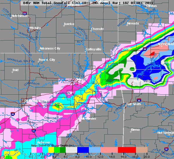
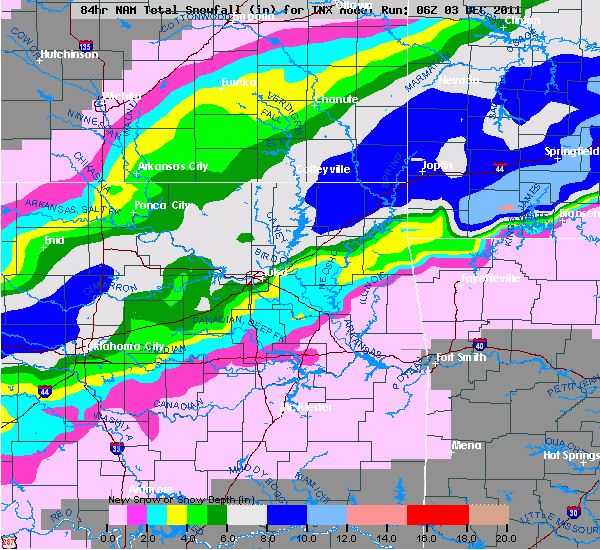
Winter Storm Still a Possibility on MondayThe models have backed down on the snowfall amounts but still have wide variances from no snow to 10+ inches in
some areas. The National Weather is holding off on a Winter Storm Watch hoping that models come into better agreement. Right now, I'm siding with the model below that puts 2-8 inches in Tulsa Metro. This is just to give everyone
an idea of what might happen as locations and amounts could still change. Updates to follow... 
Friday, December 2, 2011
Winter Weather Remains Possible on MondayRight now it appears the greatest chance for snow is from midnight Monday through Monday evening around 6:00PM with the
heaviest snow falling after 11:00am.
The two forecast snowfall models I look are drastically far apart in their
expected amounts.
The GFS model shows from 2-6 inches across the area while the NAM shows 10+ inches. The NAM nailed
the last two major snows but with the amount of moisture and lift that it appears will be available, it seems at minimum
4-5 inches overblown at this time.
All but one of the latest runs show the most snowfall south and east of
Tulsa so it seems most forecasts are trending that way.
There is also a possibility that it will stay a cold rain
but that does not look likely at this time.
With this system still a couple of days out, there is alot of refining
to do.
Updates to follow...
Winter Weather Possible Early Next WeekDetails remain fuzzy but the possibility is there for a decent winter storm Monday and Tuesday.
This is more of
an early FYI since details are still fuzzy but stay tuned over the weekend for more updates as things become clearer.
Fri, December 2, 2011 | link
|